Space-based Information Support for Decentralised Planning (SISDP)
Geospatial Technology Platform to Support e-Governance  (Version 4.0)


Geospatial Technology Platform to Support e-Governance (Version 4.0)
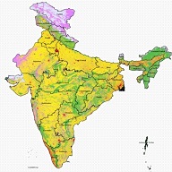
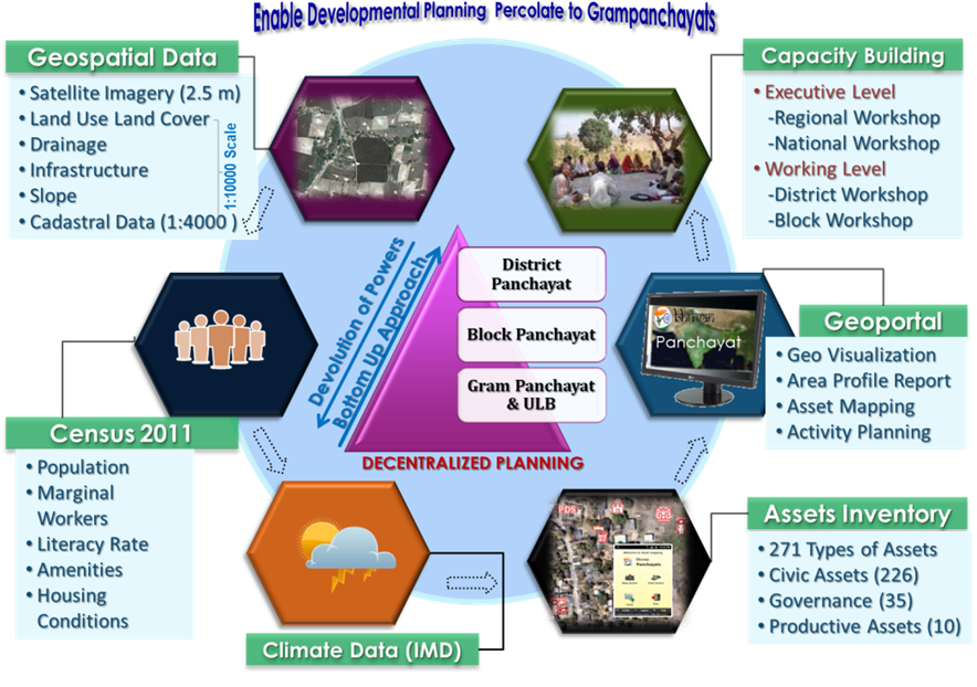
The 73rd and 74th Constitution Amendments of 1993 facilitate the realization of consistent and conscious efforts towards Decentralised planning for rural and urban areas, respectively. These amendments have provided much-needed constitutional legitimacy to local governance institutions, defined their functional domains and provided financial devolution to these institutions. The Space-based Information Support for Decentralised Planning (SISDP) project was formulated by NRSC and was implemented in partnership with State Remote Sensing Application Centres in the country to provide basic planning inputs derived from satellite data. The major deliverables, viz., satellite image of 2.5 m resolution for the entire country and thematic maps on a 1:10000 scale, generated for the first time in the country, are extremely useful in meeting the current requirements of planning, development, implementation and monitoring activities at Panchayat / Village Level.
“Empowering Panchayati Raj Institutions (PRIs) and the Stakeholders with Space-based Information Support for Decentralised Planning and Governance ”.
Together, let's leverage the power of thematic data layers for enhanced understanding and sustainable development in rural areas.
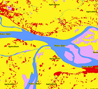
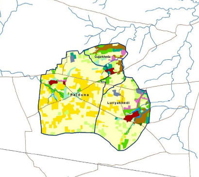
Our Land Use Land Cover data layer offers valuable insights into land use types and distribution across different regions. This data provides a comprehensive understanding of the Earth's surface, including forests, urban areas, agricultural land, water bodies, and more. Our data can assist users in making informed decisions related to land management, resource allocation, and sustainable development.
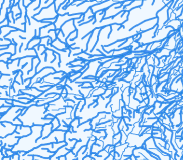
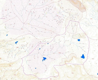
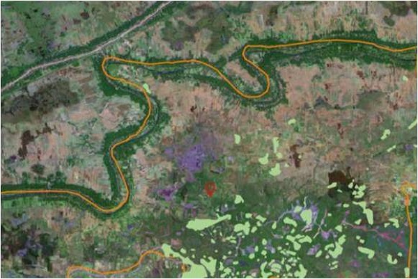
Understanding the distribution and characteristics of drainage systems and water bodies is crucial for various fields, such as hydrology, water resource management, and environmental studies. Our drainage and water bodies data layer offers detailed information about rivers, lakes, reservoirs, wetlands, and other water features. This data enable users to assess water availability, monitor water quality, and analyze flood risks for sustainable water management.
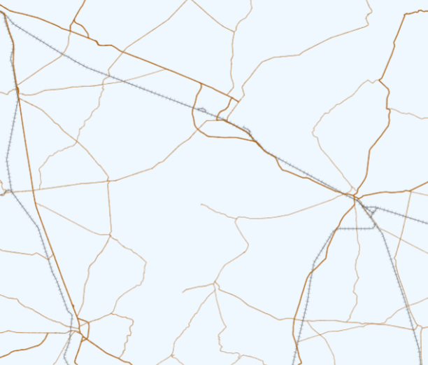
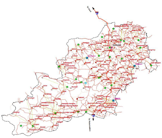
Efficient transportation and infrastructure networks are vital for economic development and connectivity in rural areas. Our infrastructure data layer includes information on roads and railways, providing a comprehensive overview of transportation routes and networks. This data assists users in transportation planning, infrastructure development, logistics optimization, and assessing accessibility to various areas.
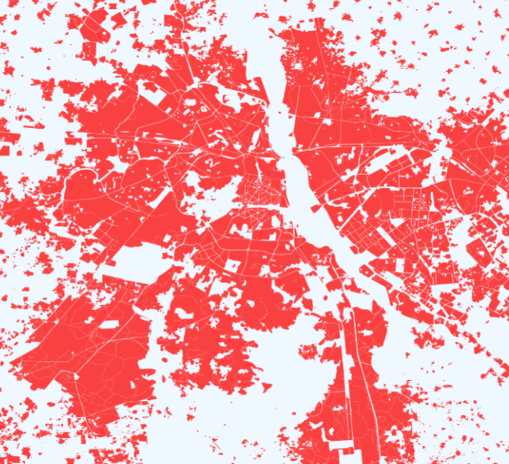
Our settlements data layer focuses on human settlements, providing comprehensive information about urban areas, towns, and villages. This data helps the user to understand the spatial characteristics and patterns of settlements, supporting their work in urban planning, infrastructure development, and demographic analysis. This data is invaluable in understanding the dynamics of human habitation and guiding development initiatives.
In India, Gram Panchayat (GP) is the basic unit in the bottom-up model of Decentralised developmental planning. Land and water resources development planning in rural areas is a subject matter of local authorities from Panchayati Raj Institutions (PRIs) and endeavours are being made to orient the space technology towards providing technical assistance in preparing sustainable development plans.

Generate and download Land Resources Development Plan (LRDP) and Water Resources Development Plan (WRDP) products
Generate and download Amenities Planning products
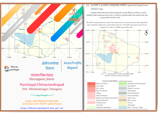
Generate and Download Panchayat Area Profile Reports
Panchayat level spatial planning and prioritization
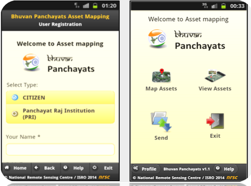
Apps for Mapping Assets
| CENTRE | NAME | PHONE | |
|---|---|---|---|
| NRSC | Dr. Prakash Chauhan, Director | director[at]nrsc[dot]gov[dot]in | 040-23884001 |
| RRSC-NRSC | Dr. S.K. Srivastav, Chief General Manager(RRSCs) Shri. S.S Rajasekhar, Head Applications |
cgm[at]nrsc[dot]gov[dot]in ssraj[at]nrsc[dot]gov[dot]in |
011-26400754 040-23884553 |
| RRSC-North | Shri. Sameer Saran, Deputy General Manager (DGM) Ms. Khushboo Mirza, Systems Manager |
sameer_s[at]nrsc[dot]gov[dot]in khushboo_m[at]nrsc[dot]gov[dot]in |
011-26400746 011-26406502 |
| RRSC-East | Dr. Suparn Pathak, Deputy General Manager (DGM) Shri. Arindam Guha, Head Applications |
s_pathak[at]nrsc[dot]gov[dot]in arindam_g[at]nrsc[dot]gov[dot]in |
033-23410001 033-23416816 |
| RRSC-South | Shri. Ramachandra Hebbar, General Manager (GM) Shri. Nagajothi K, Head Applications |
hebbar_kr[at]nrsc[dot]gov[dot]in nagajothi_k[at]nrsc[dot]gov[dot]in |
080-23026950 080-23026034 |
| RRSC-West | Dr. Apurba Kumar Bera, General Manager (GM) Dr. Rakesh Paliwal, Head Applications |
bera_ak[at]nrsc[dot]gov[dot]in rakesh_p[at]nrsc[dot]gov[dot]in |
0291-2796394 0291-2796381 |
| RRSC-Central | Dr. G. Sreenivasan , General Manager (GM) Dr. A.O. Varghese, Head Applications |
sreenivasan_g[at]nrsc[dot]gov[dot]in varghese_ao[at]nrsc[dot]gov[dot]in |
0712-2851202 0712-2851203 |
| NESAC | Dr. S.P. Aggarwal, Director Dr. Jonali Goswami, Program Coordinator |
director[at]nesac[dot]gov[dot]in jonali.goswami[at]nesac[dot]gov[dot]in |
364 2570140 364 2308 716 |
| ISRO-HQ | Dr. J.V. Thomas, Director EDPO Dr. Rajeev Jaiswal, Associate Director (Urban & Env.) |
jvthomas[at]isro[dot]gov[dot]in rajeev[at]isro[dot]gov[dot]in |
80-22172445 80-22172446 |
Space-based Information Support for Decentralised Planning (SISDP) project was formulated by NNRMS/ISRO to support the integration of space-based information into developmental planning at a 1:10k scale. Execution is done by NRSC and its Regional Centres in partnership with State Remote Sensing Centres, line departments, and academia.
Photo Gallery
Click on the image for an enlarged view.
Latest Updates
ATLAS
Click on the image for an enlarged view.
At many places in this website, you may find weblinks to other websites / portals. These links have been placed for your convenience. NRSC, ISRO is not responsible for the contents of the linked destinations and does not necessarily endorse the views expressed in them. Mere presence of the link or its listing on this website should not be assumed as endorsement of any kind. We cannot guarantee that these links will work all the time and we have no control over availability of linked destinations.
We do not object to you linking directly to the information that is hosted on this website and no prior permission is required for the same. However, we would like you to inform us about any links provided to this website so that you can be informed of any changes or updations therein. Also, we do not permit our pages to be loaded into frames on your site. The pages belonging to this website must load into a newly opened browser window of the User.
Content in the Bhuvan panchayat Website
Bhuvan panchayat website allows you to access and view a variety of content, including but not limited to IRS imagery, map and terrain data, geospatial vector information like administrative boundaries, soils, census data and other related information provided by Bhuvan panchayat, its licensors, and its users. You understand and agree to the following: